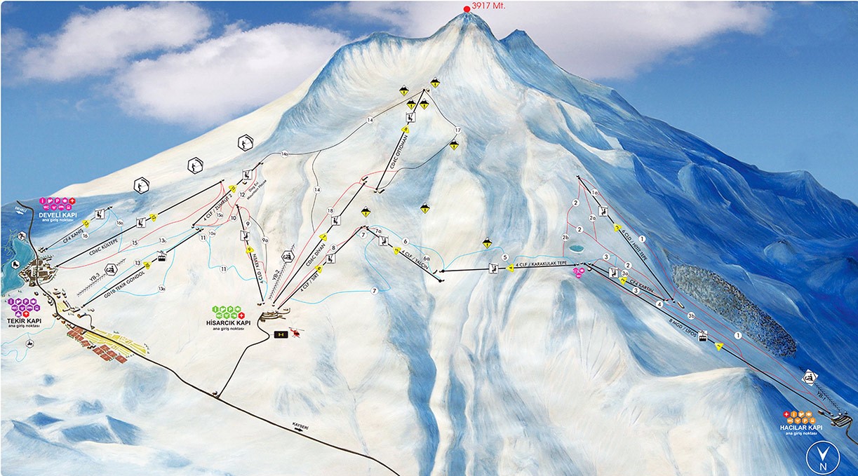


Mount Erciyes is a 3917-meter-high extinct volcano. The mountain, which last erupted in 6880 BC, is located within Kayseri's provincial borders. Alpinists, skiers, and snowboarders frequent it. It is also popular among mountain bikers.
Erciyes Mount (Greater Erciyes), located 25 kilometers southwest of Kayseri city center, has a summit elevation of 3916 meters. Another 2700-meter-high hill, Safrakaya (Minor Erciyes), lies to the west of the summit. The other hills in the area range in height from 2200 to 2700 meters.
The Tekir Plateau is the most popular route for climbers to Mount Erciyesin both the summer and winter. (The most popular climbing routes: Ridge Route, Devil Throat Route, Nesrin Topkap Route, Shepher Lair Campground, and Milk-Freezing Campground)
The Erciyes Ski Center is located 25 kilometers from Kayseri's city center. There are 55.1 kilometers of slopes for skiing and snowboarding. The mechanical facilities, which are equipped with the most advanced technology at international standards and have a large capacity, provide the opportunity to see a unique view from many points on Erciyes. You can travel comfortably indoors with your family using the "Gondola" transportation systems at the Hacılar and Tekir Gate entrances.
Mount Erciyes is one of the most important Snowkite sports destinations in the world. Erciyes is a special place for snowkite because of the consistent wind and lack of trees. It also has one of the world's few official snowkite areas.